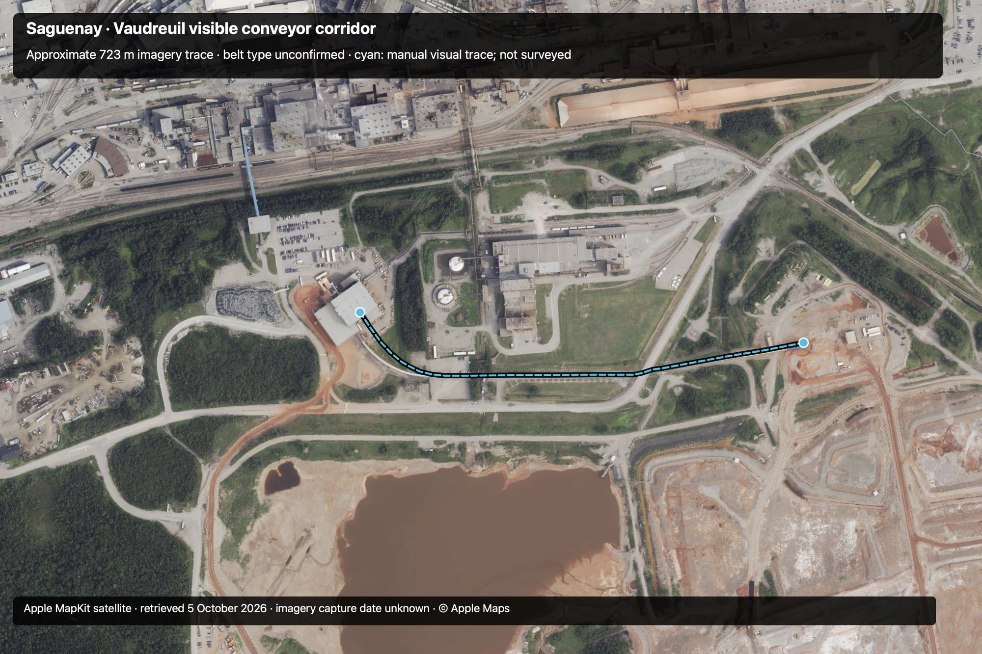
Open the interactive map to compare the trace with satellite or street imagery.
What the trace establishes
The corridor was selected from a supplied Apple Maps screenshot and matched to a georeferenced MapKit snapshot using the plant buildings, rail yard, Rue Drake and residue areas. The 21 visual picks follow the covered corridor from the southeast edge of the western transfer building to the west edge of the blue receiving cover. The short obscured road crossing follows the alignment visible on either side.
The approximately 723 m length describes only this visible segment. Pulley centres, extensions beyond the covers, flow direction, elevations, operating state, capacity and belt construction remain unverified.
Hatch documents conveyor transport to Vaudreuil’s residue disposal areas, but does not identify this exact segment. Its connection with that duty is an inference from the site and imagery. Rio Tinto’s filtration commissioning announcement provides project context.
Sources
- User-supplied Apple Maps screenshot, 5 October 2026; visible corridor south of the refinery.
- Native Apple MapKit satellite snapshot, retrieved 5 October 2026; projection controls and pixel picks retained in the research archive.
- Hatch · Vaudreuil 2022 — Phase I: residue moves by pipeline to filtration and by conveyor to disposal areas.
- Rio Tinto · Vaudreuil filtration commissioning, 24 October 2019: refinery project context.
- BEUMER · Grande-Anse/Saguenay port conveyor contract: separate port project.